
Kelpy Time Machine at Deep Sea News
The good folk at Deep Sea News have been kind enough to let us guest post on their blog. Go check it out!
Endangered Kelp Forests in Tasmania
Not seeing much kelp in the Tasmania images taken in recent years? This may be due to the fact that this region has seen dramatic declines in Giant Kelp (Macrocystis) over the past few decades. This decline has been linked to warming sea temperatures off the east coast of Tasmania. The loss of this critical habitat has been so dramatic that the Australian government has listed the forests as endangered. This is the first time that an entire ecological community has been given this kind of protection.
One major goal of this Zooniverse project is to better document these declines. While SCUBA diving is a great way to see and study kelp forests, divers can’t get everywhere and so there are many places where we don’t know how much kelp has been lost. With your help we can observe the entire coastline of Tasmania! And we will get many views of this coastline each year going back to 1984! So don’t get discouraged if you aren’t seeing kelp in the more recent years. These zeroes are incredibly important data for us. If we start seeing kelp in those same places when we look at images from the 1980s and 1990s then we can measure how much kelp has been lost.
Read more about the Tasmanian kelp declines here and here.
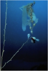
A nutrient starved kelp frond. Photo courtesy of the SBC LTER
The Image Policing Power of the Crowd, or, Let them See Kelp!
A number of you have noticed that there are a lot of images that are either of land, rivers, lakes, or are just plain bad images, cut off in some places. What gives? I want my kelp!

Land land land. But pretty awesome to see how humans alter the landscape!
Well, so do we.
When we get images from Landsat, they’re huge! About 40000km2 (200 km x 200 km). And it’s incredibly difficult to see the kelp at that scale. So, we need to chop the images into bite-sized pieces for your delectation. The Zooniverse team has put together a great algorithm to do this. Here it is, as relayed by Chris Snyder:
1) We start with a raw Landsat image that you are familiar with.
2) That image is chunked into a bunch of small squares.
Next, we run a geospatial query over the images using coastline data (http://openstreetmapdata.com/data/coastlines). We use the PostGIS plugin of PostgresSQL to accomplish this.
3)Region that intersect with the coastline shapeline are selected. You achieve something like this: http://i.imgur.com/0DS1BNU.jpg
One problem – if their algorithm is too aggressive, legitimate pieces of coastline to search get dropped, and we lose precious data.

Maybe the earth does have an edge you can fall off?
So what to do?
The simple answer is to add squares *next* to areas selected as coastline. This results in a lot of kruft – image edges that look weird, areas of all land, etc. It’s a bummer. However, this is where the power of the crowd comes in. The number may be tinkered with in the future, but currently, when 3 people submit an image and don’t mark any kelp on it, it is kicked out of the system.

I mean, I love the Sea, but this is a bit much…
So, see an all-land image? Click next. See an all sea image? Click next. See a cutoff edge? Clock next.
If two other people also click next, no one will ever see the image again. Then we can focus down on those images where at least 1 in 3 people have seen some glimmer of kelp – even if mistakenly – so that even more folk can look at it and lasso some kelp. This means that bad images will be quickly kicked out so that we can all spend our time with kelp. Because, frankly, who wouldn’t want to just spend all of their time with kelp?
Little Fluffy Clouds over Kelp
A number of folk have noticed that many of the images are full of clouds. Clouds can make it hard to see kelp – or hard to see if the image is even on the coastline!
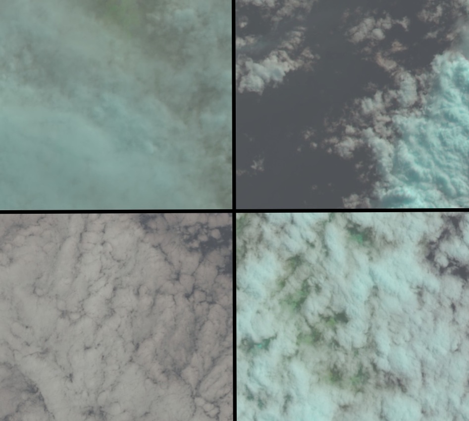
Four images with clouds. In some of them, it’s hard to even tell if there’s a coastline under there!
What’s going on here? Well, Landsat takes images approximately twice a month. But it does so without regard to tide, weather, etc. As many temperate areas have period of fog, or marine layers moving in, getting an image with a cloud-canopy isn’t too surprising. As Samuel Clemens wrote, “The coldest winter I ever spent was summer in San Francisco.” That marine layer can make things difficult, but we have the power of the sheer number of images present so that we should be able to get some good cloud-free glimpses of many forests!
Clicking the cloud button helps us out a lot, though. As we filter through the images in the future, we’ll know which ones folk may have had a hard time seeing through to see the kelp. And if enough folk don’t mark anything in the image, it will get kicked out of the system soon anyway!
Cloudy? Click cloud! ![]()
Welcome to Floating Forests!
Welcome to the blog for Floating Forests! We’re totally excited to bring you into our kelpy world! What do I mean? Well, we’re a team of scientists (more on that later) who are trying to discover whether the amount of Giant Kelp in the world is changing. And we need *you* to help us.
 Wait, Giant Kelp?
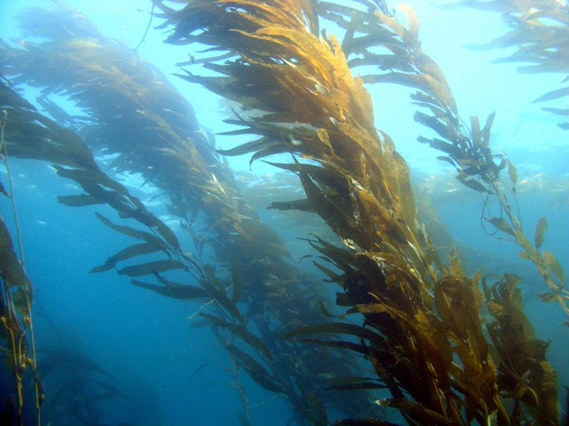
Yes, Giant Kelp! I’m talking about Macrocystis – a HUGE brown alga that can grow over 100 feet (that’s 33m) with its fronds laying across the surface of the ocean. It’s found in close to shore in colder waters – California, Chile, Tasmania, and more. Divers love it. Diving in a mature forest is like being in the Redwoods. All kinds of sea life love it, too, as it grows incredibly fast and sloughs off a lot of material for grazers to munch on every day. Kelp forests are a huge providers of services and benefits for oceans wherever they occur.
So if the amount of kelp and kelp forests in the world was changing, there could be all sorts of consequences for the services our coastal oceans can provide.
Why might it be changing?
There are a lot of reasons the amount of Giant Kelp in the world might have shrunk or grown over the past few decades: Climate change, coastal urbanization, changes in kelp-munching urchins, to name just a few. But we just don’t know.
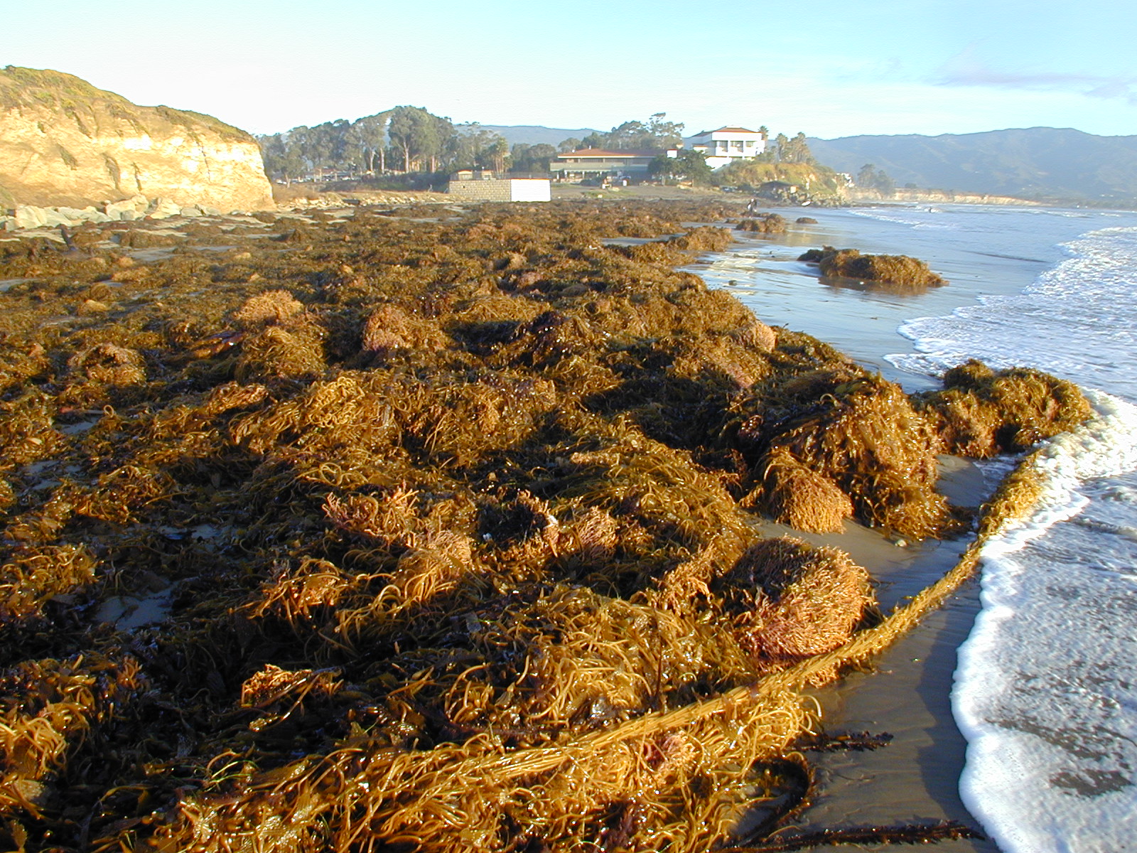
Kelp washed up on a beach after a strong El Niño. Photo courtesy of the SBC LTER.
While some awesome research programs have gone out and measured change in kelp over time at a small handfull of places, Giant Kelp is found throughout the world – often in places researchers seldom can get in the water, such as the sub-Antarctic Islands.
So, why don’t you know if the amount of Giant Kelp in the world is changing already?
Well, scientists have been monitoring Giant Kelp in some places for years. But only a few places where they can get constant good access to dive sites. And even in many of those places, by ‘years’ I mean ten, or twenty. So, something like long-term records of kelp abundances on the sub-Antarctic Islands? Nope. We’ve got nada. Heck, there are even areas in California or Chile where people have been working for decades, but are too difficult to access, so we don’t have any data.
But we have a solution. We can see Giant Kelp from space.
Kelp from space?
Kelp! From! Space! We’re very excited.
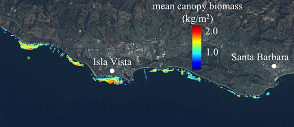
An image from some of Kyle’s early work on using satellites to see kelp in Santa Barbara, CA.
I’ll post the origin story for this project next week, but in short, Kyle Cavanaugh, while a PhD student at UC Santa Barbara figured out how to see kelp using the Landsat family of satellites. These images provide global coverage back into the early 1980s! We potentially have over 30 years of data, waiting to be pulled out!
Yeah, sure, can’t computers just do this?
Nope.
Nope?
Nope. Things like clouds, the crests of waves, sun glint, and more can confuse image recognition algorithms. But people. People can get the job done. And so, we want to take you on a tour of the Giant Kelp forests of the world, and have you help us hunt down when and where kelp exists! Fortunately, the good folk at Zooniverse thought this was as cool of a project as we do, and so they built this amazing platform to help us bring the kelp to you!
OK, I’m interested. But who is this we you keep talking about?
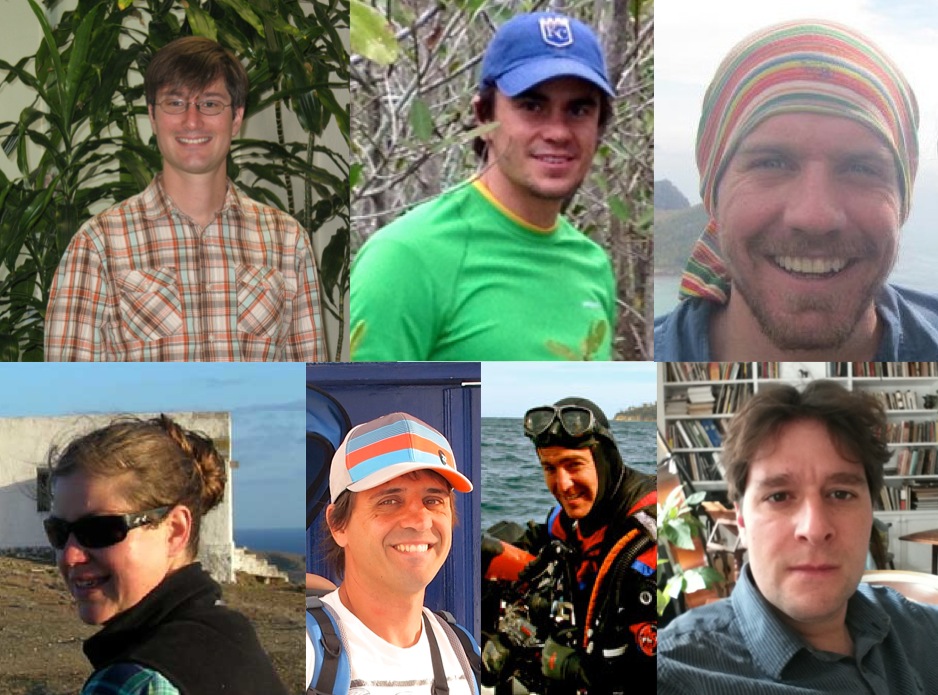
The Science team at the Floating Forests project is a group of researchers who have been working in kelp forests all of their lives. We’re divers, remote sensors, stats monkies, and all around passionate kelp enthusiasts. We’re part of the global Kelp Ecosystem Ecology Network – a network of over 60 scientists working in a wide variety of kelp ecosystems.
This project represents a dream of ours – to look at a wonderful global dataset, but to bring citizen scientists and folk just interested in looking at how their coastlines have been changing into the process with us. We hope you enjoy, and we’re really excited to tell you more about kelp forests and the amazing science that goes on there as this project moves forward!
And thanks again to the amazing team at Zooniverse for making this happen!
Coming soon…KELP!
Stay tuned to this spot as we launch later today!

Recent Comments